Multi-day
The whole W
Guided express trek
- Length5 days
- GroupUp to 4
- HostEnglish, Spanish
Find a stop on the map
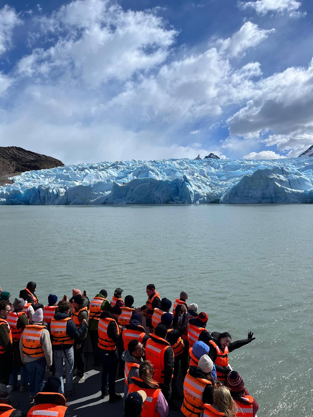
The 3-hour boat to Grey Glacier
★ 4.5 · 366 ratings
Brief answer
On the Torres del Paine W trek, the Grey Glacier leg runs 11 km from Paine Grande to Refugio Grey, about 3 hours 30 minutes, with viewpoints over the ice and hanging bridges on the trail north toward Paso.
Trail in brief
Discover 25 stops
Select a route, then tap a marker or stop to see its note and open Google Maps.
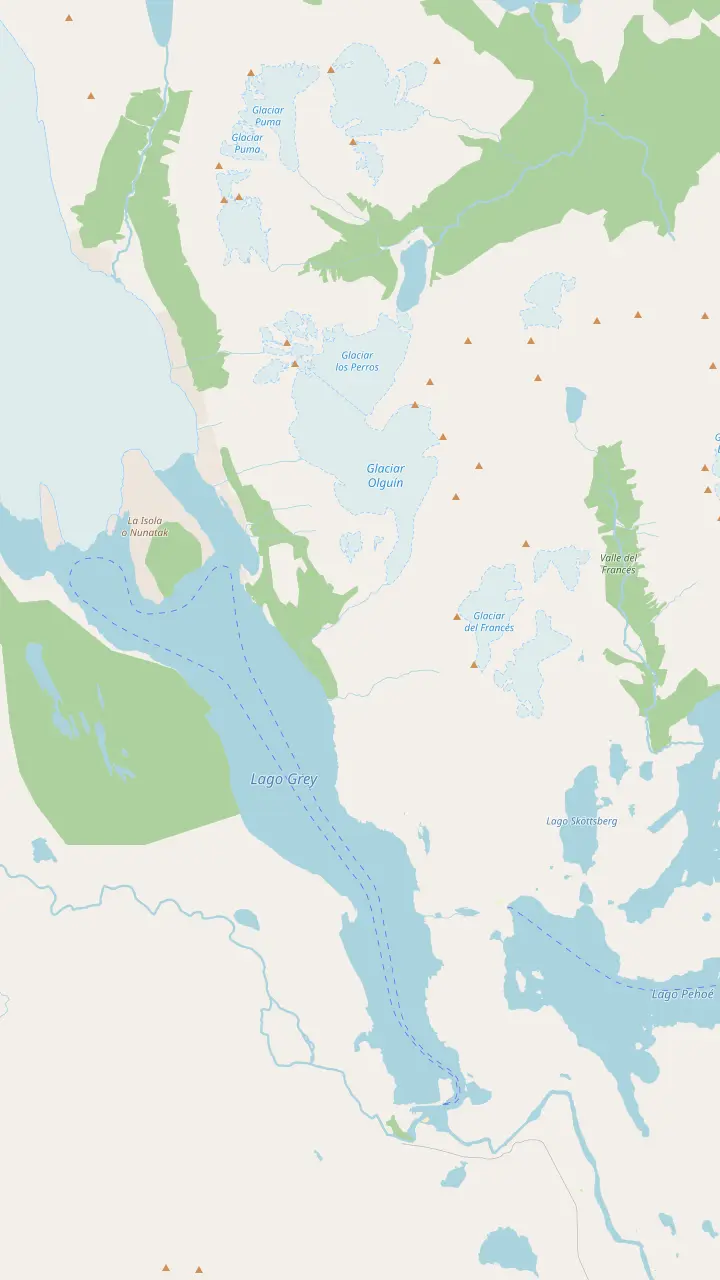
The lodge and campsite where the Grey leg starts; it is 11 km to Refugio Grey.
Google MapsThe pier where the catamaran from Pudeto lands walkers at Paine Grande.
Google MapsA small lake passed on the trail between Paine Grande and Refugio Grey.
Google MapsThe lookout on the W where the lake and the ice first open up ahead of walkers from Paine Grande.
Google MapsThe refugio near the eastern ice front, reached by trail or by the morning and midday boats.
Google MapsThe lookout above the refugio, facing the ice wall and the floes on the lake.
Google MapsThe first hanging bridge on the trail north to Paso; CONAF warns that these bridges stand more than 20 m high.
Google MapsThe campsite at the north end of the Grey trail, with an informal lookout over the glacier.
Google MapsThe highest summit of the Paine massif, at 3,050 m by CONAF's figure.
Google Maps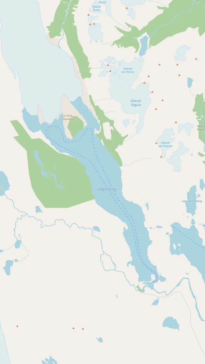
The western front of the glacier; NASA measured the greatest ice loss on this lobe between 1986 and 2007.
Google MapsThe rock island that splits the glacier's end into lobes, the kind of crag glaciologists call a nunatak.
Google MapsThe lookout above the refugio, facing the ice wall and the floes on the lake.
Google MapsThe first hanging bridge on the trail north to Paso; CONAF warns that these bridges stand more than 20 m high.
Google MapsThe campsite at the north end of the Grey trail, with an informal lookout over the glacier.
Google MapsThe refugio near the eastern ice front, reached by trail or by the morning and midday boats.
Google MapsThe boarding point, reached on foot across Playa Grey in 30 to 45 minutes from the beach car park.
Google MapsThe lakeside hotel that runs the Grey III boat; passengers check in here an hour before each sailing.
Google MapsThe wooded peninsula at the end of the beach, with a view up the lake to the floating ice and the distant fronts.
Google Maps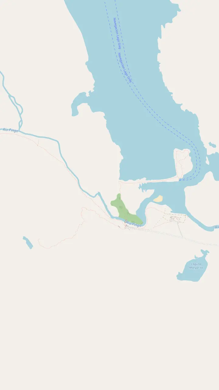
The lakeside hotel that runs the Grey III boat; passengers check in here an hour before each sailing.
Google MapsThe boarding point, reached on foot across Playa Grey in 30 to 45 minutes from the beach car park.
Google MapsThe wooded peninsula at the end of the beach, with a view up the lake to the floating ice and the distant fronts.
Google MapsThe Pingo ranger station and car park at the southern end of the lake, near the Mirador Ferrier trail.
Google MapsA short, steep trail to a wide view over the lakes, as Chile Travel describes it.
Google Maps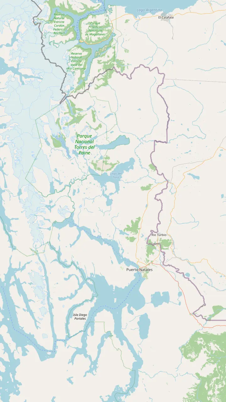
The gateway town for the park, 80 km from its entrance by Chile Travel's figure.
Google MapsThe Teniente Julio Gallardo airfield, 15 minutes from the town center.
Google MapsThe village at the Río Don Guillermo crossing, 52 km from the park's Sarmiento entrance.
Google MapsThe eastern park entrance, about 2 hours by bus from Puerto Natales.
Google MapsThe landing on Lago Pehoé, with a cafeteria, where buses and the catamaran meet.
Google MapsThe Pingo ranger station and car park at the southern end of the lake, near the Mirador Ferrier trail.
Google MapsThe lakeside hotel that runs the Grey III boat; passengers check in here an hour before each sailing.
Google Maps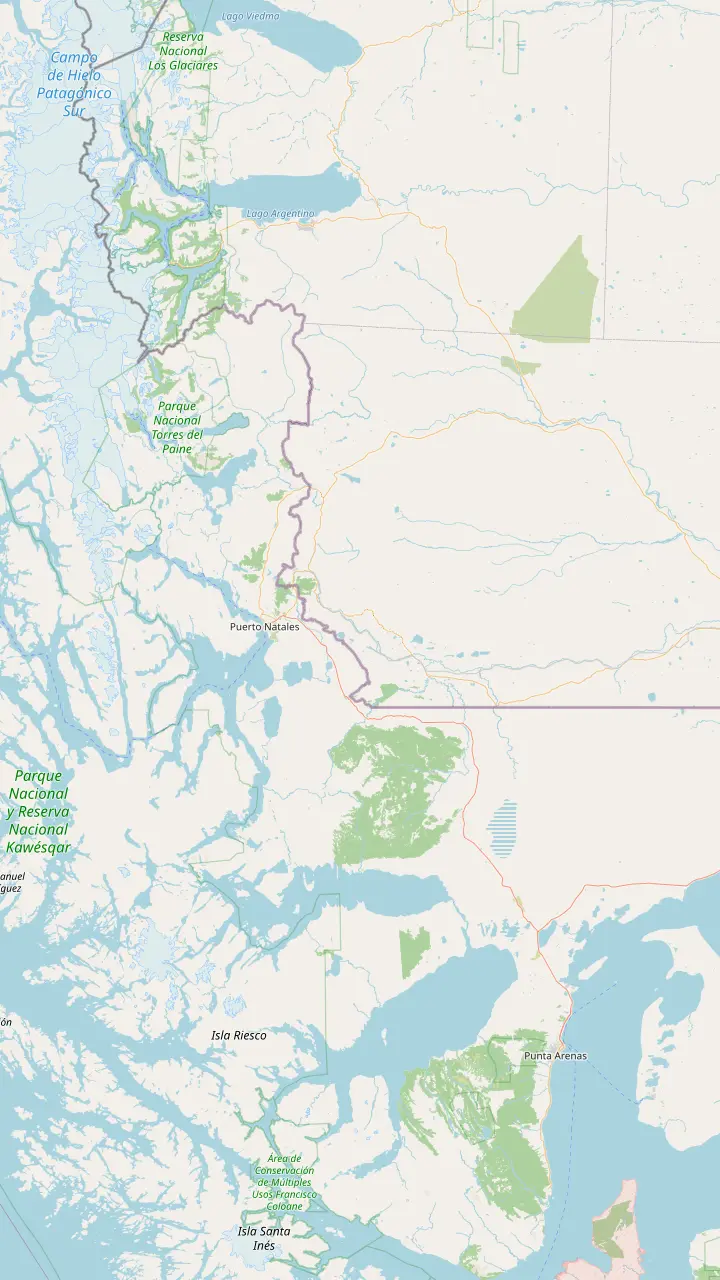
The regional capital, 250 km and about 3 hours by road from Puerto Natales.
Google MapsThe Carlos Ibáñez del Campo airport, open all year with daily flights from Santiago.
Google MapsThe gateway town for the park, 80 km from its entrance by Chile Travel's figure.
Google MapsThe Teniente Julio Gallardo airfield, 15 minutes from the town center.
Google MapsThe village at the Río Don Guillermo crossing, 52 km from the park's Sarmiento entrance.
Google MapsThe Chilean border complex on the road to El Calafate, open to all vehicles, at 260 m above sea level.
Google MapsThe Argentine town on the far side of the border, 5 hours from Puerto Natales by scheduled bus.
Google MapsThe eastern park entrance, about 2 hours by bus from Puerto Natales.
Google MapsThe lakeside hotel that runs the Grey III boat; passengers check in here an hour before each sailing.
Google MapsMap data: © OpenStreetMap contributors
Editorial team, greyglaciercruise.click · Updated November 12, 2026 · Reading: 8 min
Quick look
Chile Travel describes the W as a route of 70 km that traces its letter through the park's valleys,6 and explains that the name comes from joining the Ascencio, Francés and Grey Glacier valleys, over 4 to 6 days with hikes of up to 8 hours a day.7 The Grey section is the western arm of that letter, the stretch that ends in front of the ice rather than below the granite towers.
For anyone walking the Torres del Paine W trek, the Grey Glacier leg is often the last or the first full day, depending on direction. Chile Travel's day-by-day plan puts it at the end: from Paine Grande you walk to the Grey viewpoints and back, about 8 hours in all over rolling ground, until the ice wall and the floating floes come into view.2 It is a long day, and CONAF rates the walk to the refugio as medium in summer.1
Remember that the W is linear. Chile Travel stresses that you finish far from where you started,8 so the Grey arm needs a plan for getting in or out. Chile Travel's plan links it to the catamaran across Lago Pehoé to Pudeto, where buses leave for Puerto Natales,9 and the Grey boat offers another way to skip the return walk. Both options are covered below.
Trail data
| Section | Length | Time | Note |
|---|---|---|---|
| Paine Grande to Grey | 11 km | 3 h 30 min | Medium in summer |
| Paso to Grey | 7 km | 5 h | Closed in winter |
| Paine Grande to admin | 17 km | 5 h | To the park office |
| Paine Grande to viewpoints and back | Full day | About 8 h | Long day |
CONAF trail data; the round-trip estimate is Chile Travel's. Paso to Grey is closed in winter.1,15,16,2
CONAF's trail data for this section is precise. The walk from the Paine Grande ranger station to the Grey ranger station is 11 km long, a walk of about 3 hours 30 minutes, rated medium in summer and moderate in winter, with risks of snow, mudflows and avalanches from May to September.1 For the 2026-2027 summer season the park bulletin sets the latest start from Paine Grande towards Refugio Grey at 15:30,11 while its 2023-24 leaflet gave 16:00 in summer and 12:00 in winter for the walk the other way, from Grey to Paine Grande.12
The trail climbs away from the Pehoé shore and passes Laguna Los Patos before the first big view of the lake opens at the Lago Grey lookout, both marked on the trek tab of the map. From there it follows the eastern side of Lago Grey north, through forest and over open slopes, with the ice growing larger ahead. Expect wind on the exposed stretches and shelter only in the wooded parts.
Refugio Grey sits at the end of this leg, close to the glacier. CONAF lists it among the refugios without vehicle access,10 and Vértice Patagonia operates the refugios and campsites on this side of the park, Grey and Paine Grande among them, according to Chile Travel.13 If you plan to sleep there, book early: Chile Travel advises reserving refugios and campsites months ahead, 6 months or more for the W.14
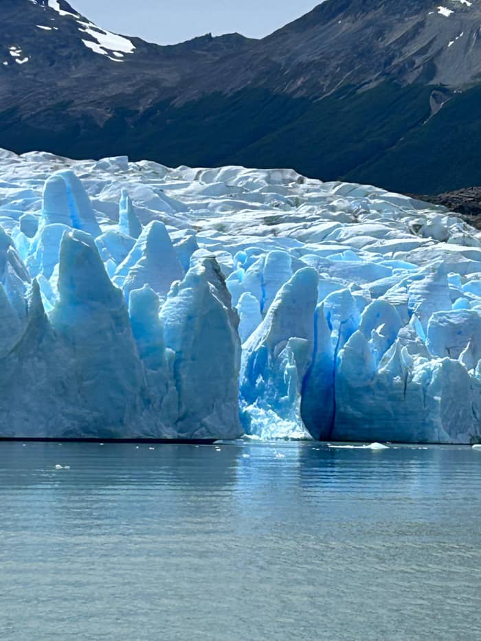
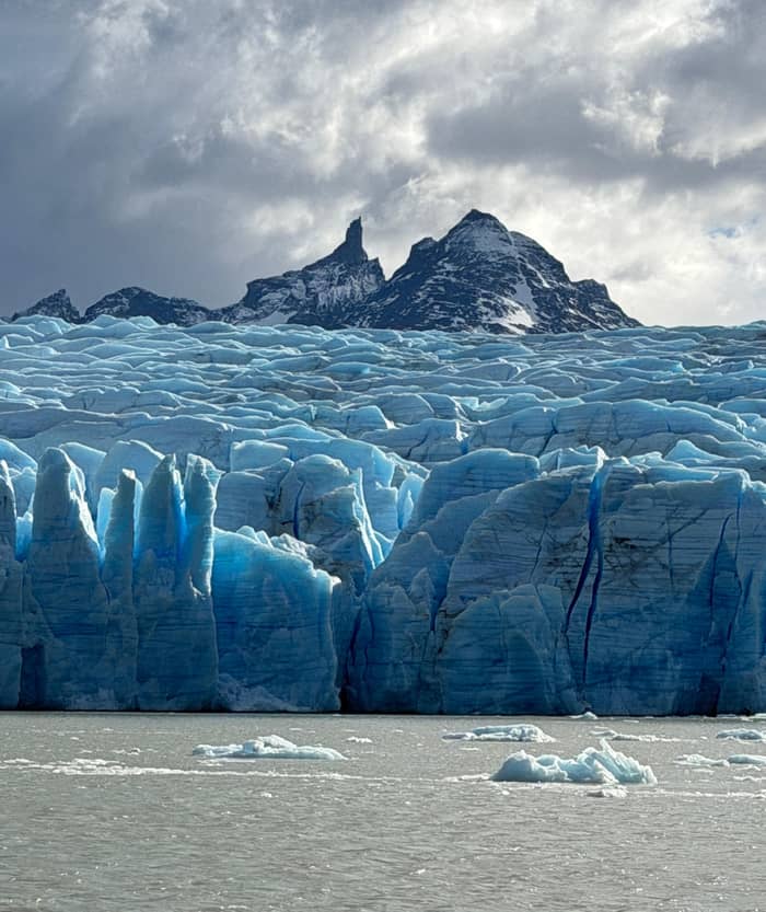
Close to the refugio, the trail reaches the main Grey Glacier viewpoint in Torres del Paine, a rocky lookout above the water where the eastern front of the ice fills the view. Chile Travel describes the end of this walk as the moment you stand facing the immense ice wall and the floes drifting on the lake,2 and on a calm day the reflections of the blocks in the gray water double the scene.
The ice front here is the same wall the boat visits, seen from land. The ice cliffs stand 30 m above the water in Chile Travel's figure,19 and NASA's account has the glacier splitting into three lobes where it meets the lake,20 so from the shore you see only part of the whole front. The boat, by contrast, swings along all of them, and that is the case for sailing even after you have seen the ice from above.
Farther north the views keep improving. The CEQUA guide's photographs include a view of the ice from an unofficial lookout at Campamento Paso,21 high above the ice on the route of the O circuit. That stretch is a serious hike rather than a stroll from the refugio, but even the first part of it, up to the hanging bridges, gives a raised angle on the crevassed surface of the glacier.
Plan the leg
Choose by time, fitness and how you want to see the ice.
If I am walking the full W
Walk Paine Grande to Grey
An 11 km leg ending at the refugio.1
If I want the ice from the water too
Board at the refugio early
On morning and midday boats, refugio boarders get the glacier visit.17
If I want the hanging bridges
Walk north from Refugio Grey
The bridges stand between the Grey and Paso camps.3
If I only have a day
Boat plus a short walk
Day hikes need only the park ticket.18
If I am going in winter
Hire a guide
In the 2026 winter season the W needed a certified guide.5
Approaches
Multi-day
Guided express trek
Easiest
From the hotel beach
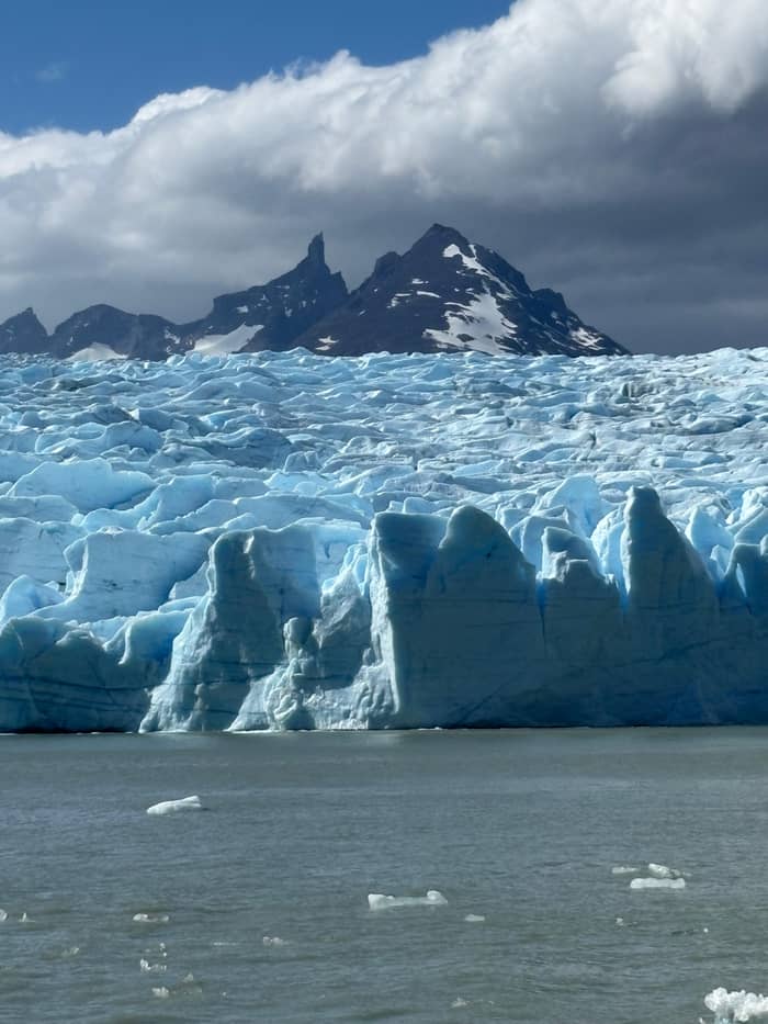
No car
With road transfer
North of Refugio Grey the trail toward Paso crosses deep ravines on hanging bridges. CONAF's English leaflet tells walkers with vertigo about the bridges on the stretch from Grey to Paso, which hang more than 20 m above the ground,3 and each crossing opens a striking view of the ice spread out below. The decks sway in the wind, so take your time, keep a hand on the cable and wait for a calmer moment if a gust catches you mid-span.
The trail to Paso is harder than the leg from Paine Grande. CONAF gives the Paso to Grey section as 7 km and 5 hours, rated demanding and closed in winter,15 and the park's 2026-2027 bulletin sets the latest departure from Paso at 15:30 in summer,40 where its 2023-24 leaflet gave 15:00 in summer and 11:00 in winter.41 Day walkers from the refugio can go as far as the bridges and turn around, keeping in mind that every step out is a step back.
Beyond Paso, the trail belongs to the O circuit. Chile Travel describes the O ringing the massif for almost 100 km and ending with the view of the Southern Ice Field from John Gardner Pass,42 and it notes that this circuit calls for a certified guide in its most remote sections,43 while CONAF's 2026-2027 bulletin opens the O for independent trekking for the summer that runs November 2026 through March 2027, with guided-only rules possible in hazardous weather.44 On the W you only touch its southern end, but the bridges give a taste of that wilder country.
Plan your Grey day
From a single sailing to the full W with a host.
Compare 3 alternatives
From a single sailing to the full W with a host.
≈
View≈
View≈
ViewGetYourGuide's starting prices, converted at the ECB reference rate; exact pricing appears when you book.
A day on the leg
Morning
Start early; the leg is 11 km to Refugio Grey.1
Mid-morning
A small lake on the trail before the first lake view.
Late morning
The first wide view of the lake and the ice.
Midday
Rest at the lodge near the glacier.10
Early afternoon
Face the ice wall and the drifting floes.2
Afternoon
Walk back to Paine Grande or catch a scheduled sailing.4
The Grey III catamaran doubles as a shuttle between the hotel and the refugio. Hotel Lago Grey's morning and midday departures head first to Refugio Grey on a timetable, pausing for passengers holding single-leg tickets, and then carry on to the ice;4 round-trip passengers cannot get off there.45 The afternoon boat visits the glacier first and calls at the refugio afterwards.46
The direction you travel decides whether you see the glacier from the water. On the morning and midday boats, passengers getting off at the refugio do not get the glacier visit,47 while those boarding at the refugio on the same boats do.17 If you finish the W at Grey and want to see the fronts by boat, board at the refugio on an early sailing and ride the full loop back to the hotel.
Timing matters at the beach. The operator asks passengers boarding at the refugio to be on the shore 15 minutes before the boat arrives,48 and at the hotel end the operator puts the beach crossing at 30 to 45 minutes, while the bus company counts 25 minutes from the cafe at the Pingo bridge.22,49 A park ticket is still required, as the boat reservation does not cover the entrance fee to Torres del Paine.50 Carry the downloaded ticket along with the boat confirmation, since mobile signal exists only at Villa Monzino, far from the refugio.51
Video
Alicia & Michael - Lovers Get Lost on YouTube · Nothing is fetched until you hit play.
It is crucial to understand that the W Circuit is a linear route, not circular, so you will finish the journey far from where you started.
Trail kit
You do not need to walk the whole W to see this section. Chile Travel notes that the requirement to hold overnight bookings applies to the multi-day circuits, not to day hikes or full-day visits,18 so a day visitor with a park ticket can walk part of the Grey leg. Buy the park ticket on the official website a day or more ahead, since the entrance gates do not sell them.35,52
The easiest way to taste the trail is from the hotel side. Take the boat to the fronts, then walk a short stretch of the shore or a lookout near the hotel, or ride a single leg to the refugio and walk up to the Grey viewpoint before the boat collects you again. Check the sailing times carefully, since the morning and midday boats are the ones that stop at the refugio on a schedule.4
From the Pehoé side the walk is longer. From Paine Grande the trek to the Grey viewpoints and back fills about 8 hours,2 and walking out to the park administration instead is a separate 17 km trail of about 5 hours.16 Day walkers starting from Pudeto need the catamaran across Lago Pehoé in both directions,9 which makes a fixed return time essential.
CONAF's basic rules apply to every step of this trail. Walking without daylight is prohibited,39 and the park notes that most deaths there have been of people walking by themselves who strayed from the path.38 Lighting any heat source, stoves and cigarettes included, is banned,53 and drones may not be flown.54 The trail is wild country, not a park path, and CONAF reminds visitors that rescue in the mountains may be several hours away.55
Winter changes the rules. Through the 2026 cold season, from May until mid-September, the park let nobody onto the W without a certified guide,5 and Chile Travel's winter notice added microspikes or crampons, trekking poles and a headlamp for every walker.37 From 16 September 2026 the W is open for independent hiking, but the park may require guides again in severe weather.5 The whole W shuts in June and July, per Chile Travel,56 and CONAF already classes the Paso section as closed for the whole winter.15 Check the current notices before you set out.
Pack for wind, rain and sun on the same day. Chile Travel's kit list starts with thermal underwear, adds fleece or down for warmth and finishes with a waterproof, windproof outer jacket, and it advises against cotton.36 On the bridges, hold the cables, cross singly where a sign asks, and keep your pack tight against gusts. The ice below will still be there when you are safely on the other side.
FAQ
That is Chile Travel's estimate from Paine Grande and back.2
CONAF's leaflet notes bridges more than 20 m high on that section.3
Morning and midday sailings stop at the refugio for passengers with single-leg tickets.4
Overnight reservations are required for the circuits, not for day hikes.18
Sources
More to read
Planning the boat to Grey Glacier? Ask a real person.