Just the boat
Boat with a van
Natales to the pier
- Length8 hours
- Van2 hours each way
- Walk35 minutes
Find a stop on the map
Discover 25 stops
Select a route, then tap a marker or stop to see its note and open Google Maps.
The gateway town for the park, 80 km from its entrance by Chile Travel's figure.
Google MapsThe Teniente Julio Gallardo airfield, 15 minutes from the town center.
Google MapsThe village at the Río Don Guillermo crossing, 52 km from the park's Sarmiento entrance.
Google MapsThe eastern park entrance, about 2 hours by bus from Puerto Natales.
Google MapsThe landing on Lago Pehoé, with a cafeteria, where buses and the catamaran meet.
Google MapsThe Pingo ranger station and car park at the southern end of the lake, near the Mirador Ferrier trail.
Google MapsThe lakeside hotel that runs the Grey III boat; passengers check in here an hour before each sailing.
Google Maps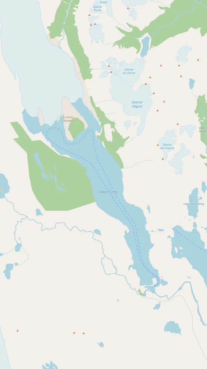
The western front of the glacier; NASA measured the greatest ice loss on this lobe between 1986 and 2007.
Google MapsThe rock island that splits the glacier's end into lobes, the kind of crag glaciologists call a nunatak.
Google MapsThe lookout above the refugio, facing the ice wall and the floes on the lake.
Google MapsThe first hanging bridge on the trail north to Paso; CONAF warns that these bridges stand more than 20 m high.
Google MapsThe campsite at the north end of the Grey trail, with an informal lookout over the glacier.
Google MapsThe refugio near the eastern ice front, reached by trail or by the morning and midday boats.
Google MapsThe boarding point, reached on foot across Playa Grey in 30 to 45 minutes from the beach car park.
Google MapsThe lakeside hotel that runs the Grey III boat; passengers check in here an hour before each sailing.
Google MapsThe wooded peninsula at the end of the beach, with a view up the lake to the floating ice and the distant fronts.
Google Maps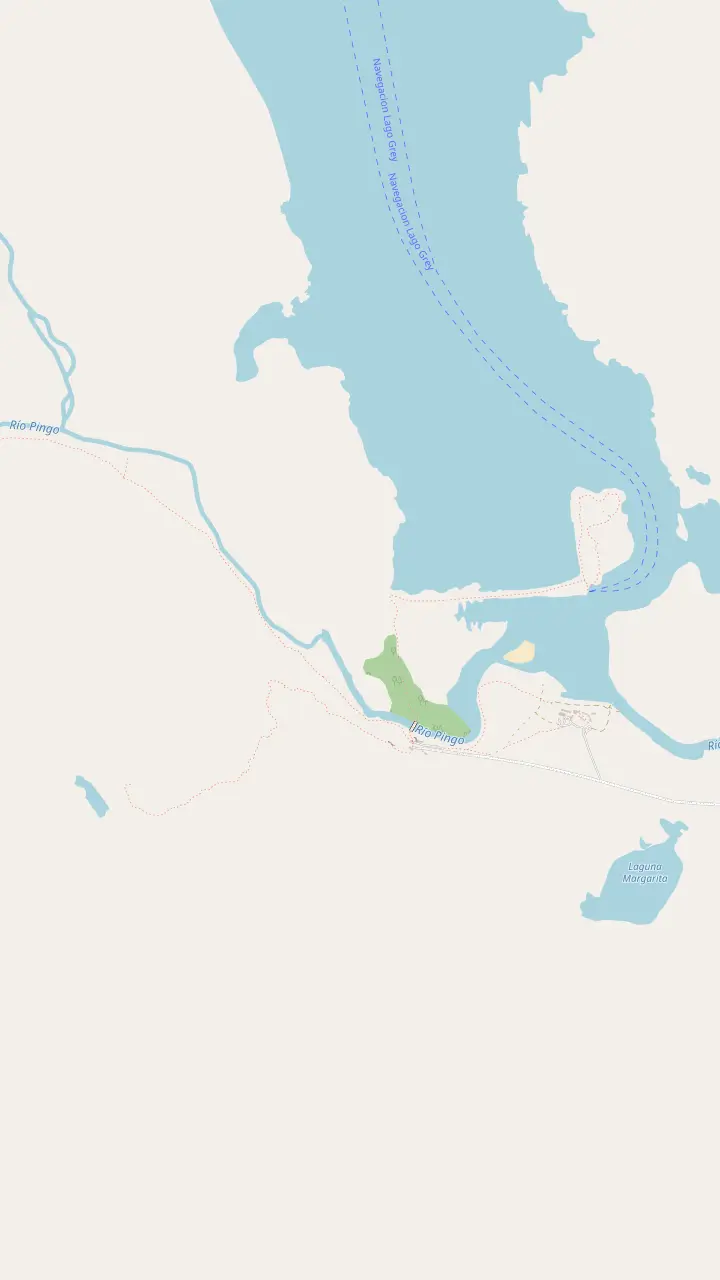
The lakeside hotel that runs the Grey III boat; passengers check in here an hour before each sailing.
Google MapsThe boarding point, reached on foot across Playa Grey in 30 to 45 minutes from the beach car park.
Google MapsThe wooded peninsula at the end of the beach, with a view up the lake to the floating ice and the distant fronts.
Google MapsThe Pingo ranger station and car park at the southern end of the lake, near the Mirador Ferrier trail.
Google MapsA short, steep trail to a wide view over the lakes, as Chile Travel describes it.
Google Maps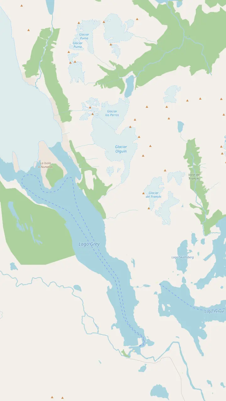
The lodge and campsite where the Grey leg starts; it is 11 km to Refugio Grey.
Google MapsThe pier where the catamaran from Pudeto lands walkers at Paine Grande.
Google MapsA small lake passed on the trail between Paine Grande and Refugio Grey.
Google MapsThe lookout on the W where the lake and the ice first open up ahead of walkers from Paine Grande.
Google MapsThe refugio near the eastern ice front, reached by trail or by the morning and midday boats.
Google MapsThe lookout above the refugio, facing the ice wall and the floes on the lake.
Google MapsThe first hanging bridge on the trail north to Paso; CONAF warns that these bridges stand more than 20 m high.
Google MapsThe campsite at the north end of the Grey trail, with an informal lookout over the glacier.
Google MapsThe highest summit of the Paine massif, at 3,050 m by CONAF's figure.
Google Maps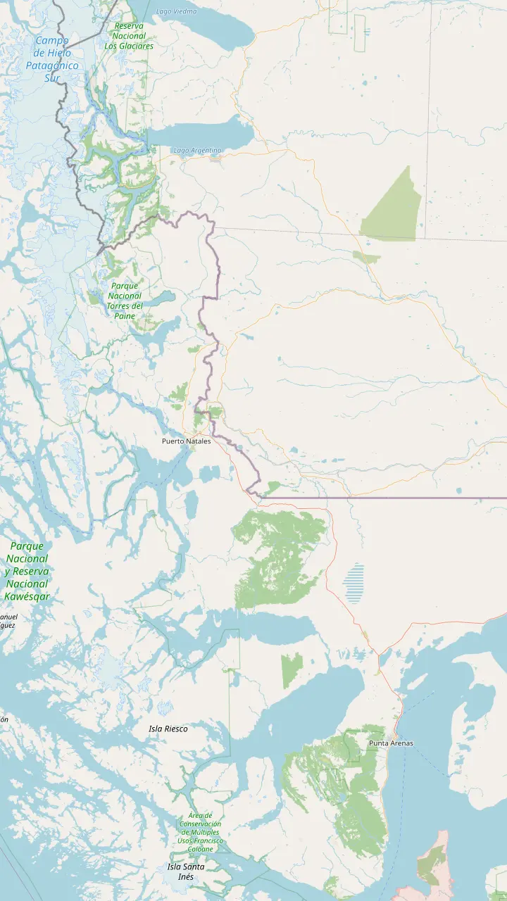
The regional capital, 250 km and about 3 hours by road from Puerto Natales.
Google MapsThe Carlos Ibáñez del Campo airport, open all year with daily flights from Santiago.
Google MapsThe gateway town for the park, 80 km from its entrance by Chile Travel's figure.
Google MapsThe Teniente Julio Gallardo airfield, 15 minutes from the town center.
Google MapsThe village at the Río Don Guillermo crossing, 52 km from the park's Sarmiento entrance.
Google MapsThe Chilean border complex on the road to El Calafate, open to all vehicles, at 260 m above sea level.
Google MapsThe Argentine town on the far side of the border, 5 hours from Puerto Natales by scheduled bus.
Google MapsThe eastern park entrance, about 2 hours by bus from Puerto Natales.
Google MapsThe lakeside hotel that runs the Grey III boat; passengers check in here an hour before each sailing.
Google MapsMap data: © OpenStreetMap contributors
Editorial team, greyglaciercruise.click · Updated November 12, 2026 · Reading: 7 min
Quick look
The Grey Glacier location in Torres del Paine is the western sector of the park, where an arm of the Southern Ice Field ends in the lake that shares its name.5 The boat that visits it starts from Hotel Lago Grey, inside the park, where your booking asks you to report 1 hour ahead of departure. From there a walk across the beach leads to the boarding point.
Count on roughly 100 km of park roads between Natales and the hotel, or about 2 hours behind the wheel.1 That distance shapes the whole day. Whatever transport you choose, plan on a long morning on the road before the sailing and a similar stretch back afterwards, and leave plenty of slack around the check-in time.
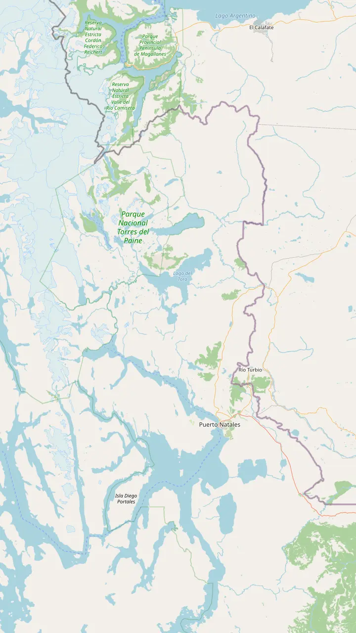
The map on this page shows the pieces in order: the town, the park gates, the CONAF administration at Villa Monzino, the hotel, the cafe by the Pingo bridge where the beach walk begins, and the pier at the end of Grey Beach. Keep it open on your phone before you lose signal, because inside the park the connection fades quickly.
Side by side
| Way | Time each way | Best sailing | Watch out for |
|---|---|---|---|
| Rental car | About 2 hours | Any | No fuel in the park |
| Public bus | Up to 4 hours | Second | Seasonal timetable |
| Tour with van | 2 hours | Set by tour | Higher price |
| Park day tour | Full day | No sailing | Lake beach only |
Road times from Chile Travel and the listings; check the season before you travel.1,13,11,14
With a rental car you have two main roads. Route Y-290 covers 80 km from Puerto Natales as far as the Serrano entrance and the CONAF headquarters, while the longer way north on Route 9 via Cerro Castillo reaches the Laguna Amarga or Sarmiento gate after 115 to 145 km.9 For the boat, the Serrano side is the natural approach, since it leads straight to the western sector.
From the CONAF administration at Villa Monzino an internal road of about 18 km continues to the Hotel Lago Grey sector.10 Fill the tank before leaving town. CONAF points out that you cannot buy fuel anywhere inside the park or nearby, so a car running low on the far side of the park is a real problem.11
A car gives you the most freedom on the day. You can stop at the lake beach before check-in, pick the first or the third sailing, and add a viewpoint on the way out. Drive the gravel slowly, watch for guanacos on the road, and keep your park pass downloaded, as the gates have no mobile data to check your email.12
The public bus is the budget route, and one operator times it around the boat. Between September and April, Bus-Sur runs a 7:00 and a 12:00 departure from Puerto Natales every day, with journeys from 2 hours depending on the stop.2 Chile Travel describes the full run as about 2 hours to Laguna Amarga, then on via Pudeto, Pehoe camping and the Administration to Hotel Lago Grey, nearly 4 hours in all.13
At the far end, Bus-Sur describes a simple routine. Its bus leaves passengers at Hotel Lago Grey for check-in, then carries them about 2 km further to the Rio Pingo cafe by the Grey bridge, where the beach walk to the Grey III pier begins.17 Bus-Sur says its service connects with the second sailing in both directions, or with the return of the first for people coming back from the Grey refuge.15
For the ride home, Bus-Sur's buses leave Hotel Lago Grey for Puerto Natales at 13:30 or 17:00.8 The hotel itself gives a different instruction for bus travellers, asking them to book its transfer in advance and to wait at the park administration, so confirm the connection with both before you travel.18 Between May and August the bus timetable changes and weather can disrupt services.14
Your route
Pick the way in that suits your trip and your budget.
If I can drive on gravel
Rental car
Follow Route Y-290 for 80 km to the Serrano entrance, then drive on to the lake.9,10
If Cheapest way, no car
Public bus
The Bus-Sur timetable is built around the second sailing, out and back.15
If No planning, no car
Boat with a van
Pickup, the beach walk and the boat in 8 hours.
If I want the park too
Boat and park day
Grey Lake plus 4 hours of sightseeing in a group of up to 10.
If I travel in winter
Check the bus first
Between May and August frequencies change and weather can stop services.14
Done for you
Just the boat
Natales to the pier
Small group
Grey plus viewpoints
Lowest price
Lake beach, no sailing
If you would rather leave the logistics to someone else, a Grey Glacier tour from Puerto Natales packages the ride and the sailing. One version lasts 8 hours with pickup included: a van of 2 hours, a walk of 35 minutes to the catamaran, 3 hours on Grey Lake, then the walk and the van back to town. It starts from $276; 34 guests have reviewed it, for an average of 4.34.
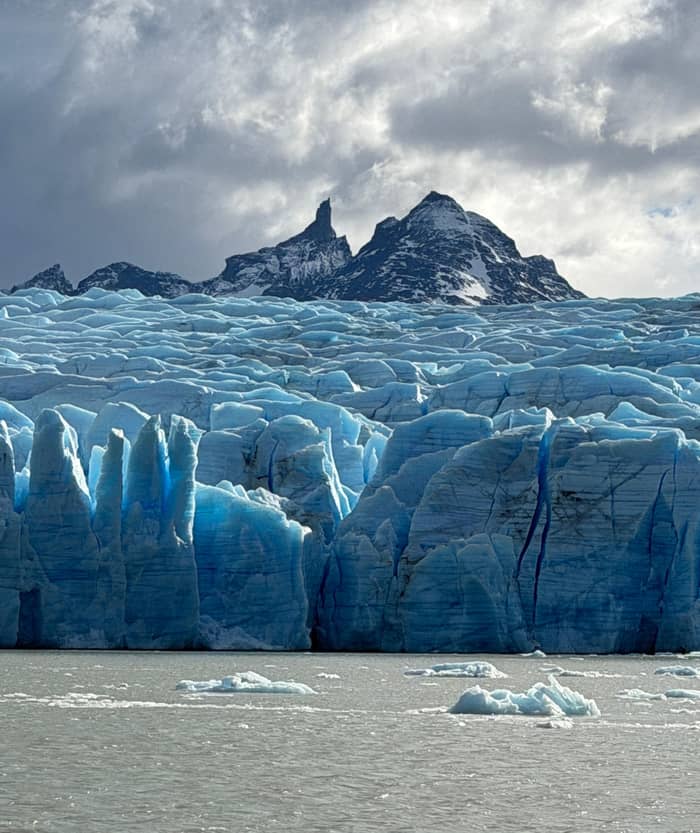
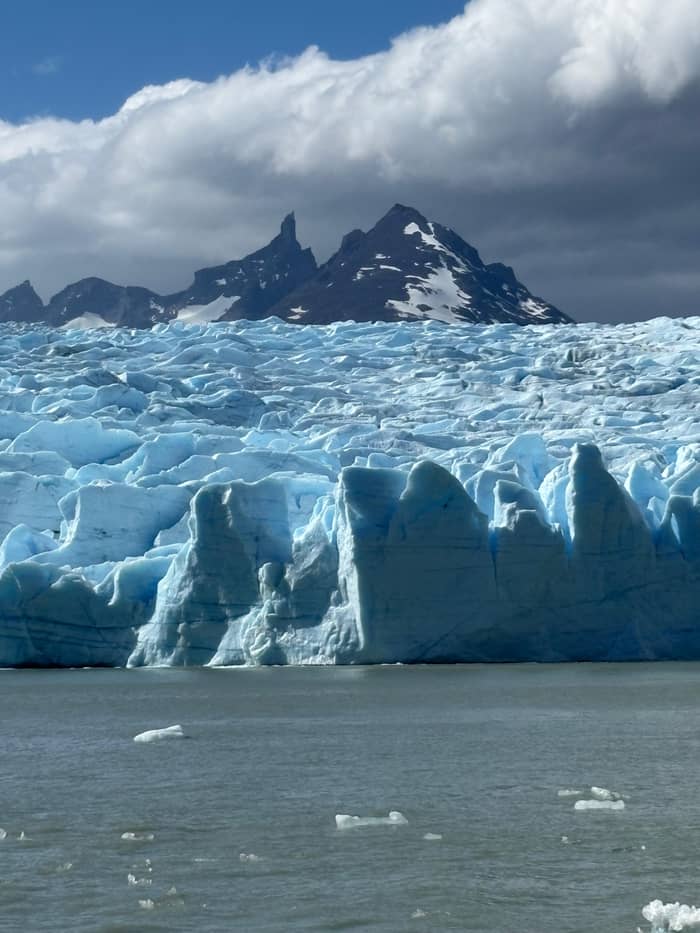
Longer days combine the boat with the rest of the park. A small-group day of 12 hours for up to 10 people pairs 3 hours on Grey Lake with 4 hours of guided sightseeing, and starts from $290. The cheapest park days skip the sailing but still stop by the lake: a 12-hour day for groups of 15 or fewer names the lake beach at Grey as a highlight and starts from $75.
Read the reviews with an eye on the transport. On the version with transport, guests score the guide 4.2, the transport 4 and value for money 3.6, so the ride is a convenience you pay for rather than a highlight. For travellers without a licence or who dislike gravel roads, that trade is often worth making.
Group total
Choose a tour with transport and the size of your group.
Compare 4 alternatives
Choose a tour with transport and the size of your group.
≈
View≈
View≈
View≈
ViewGetYourGuide's starting prices, converted at the ECB reference rate; exact pricing appears when you book.
A day by bus
Morning
Bus-Sur leaves the Natales terminal at 7:00.2
Midday
Second sailing check-in at 12:00 at Hotel Lago Grey.6
Early afternoon
Mid afternoon
The second sailing returns at 15:45.6
Late afternoon
The bus leaves Hotel Lago Grey at 17:00.8
Every route ends on foot. According to the operator the desk opens an hour ahead of each sailing, and the boat can only be reached on foot, with 30 to 45 minutes of beach walking before you board.3 The listing describes the same walk as 3 km from the closest car park, and notes that it changes with the weather.
Bus-Sur, which drops its passengers at the Rio Pingo cafe, gives 25 minutes for the walk from there to the pier.39 The sources measure the walk differently, so count on the operator's longer figure if you are slow on loose ground or the wind is in your face.
The path does not suit anyone with reduced mobility, and parents of infants are told to bring a carrier backpack, since prams and carts cannot cope with the terrain.40,41 Wind can close the beach altogether, and CONAF listed Playa Grey among the trails shut from 10 November 2026 when gusts and storms were forecast.42
Video
ASPECTS OF LIFE - Ellitomi on YouTube · Nothing is fetched until you hit play.
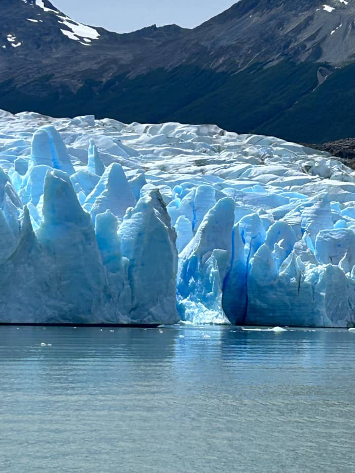
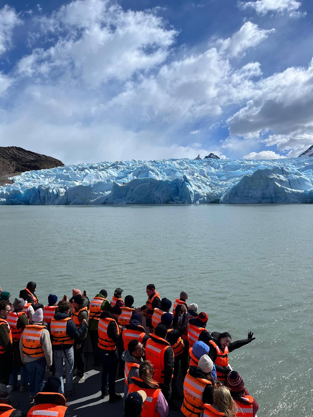
Once there, the most popular way to get close to the imposing glacier is by taking a three-hour boat trip that departs from the Hotel Lago Grey, bringing you closer to its ice fronts.
Before leaving Natales
The boat runs to a fixed timetable, so build the day backwards from it rather than forwards from breakfast. The first sailing checks in at 08:30, leaves at 09:30 and is back at 12:15.43 The second checks in at 12:00, leaves at 13:00 and returns at 15:45.6 For the last boat of the day you check in at 15:00, cast off at 16:00 and land again at 18:45.44 Every sailing calls at the Grey refuge, but in a different order, which matters only if you are meeting trekkers.45
By bus, the second sailing is the natural fit, since that is the one Bus-Sur meets in both directions.15 Its return at 15:45 leaves comfortable time to walk back and catch the bus to Natales at 17:00.6,8 By car the first sailing is possible only if you sleep inside the park or leave Natales very early, given the 2 hours of road.1
A boat will not leave with fewer than 25 people aboard, which matters on quiet days at the edges of the season.46 On busy summer days the operator adds a fourth sailing.47 Neither the minimum nor the extra sailing is something you can plan around in advance, so treat them as reasons to stay flexible on the day rather than as fixed parts of a schedule.
Do the paperwork before you leave town. The national park pass is sold online only and has to be purchased a full 24 hours or more before you enter; the gates sell none.4,48 The boat operator is explicit that its ticket never replaces the park fee.49 Buy a pass for everyone in the group aged 13 or over before the day, since only children up to 12 enter free,50 and keep a screenshot of each one, so nobody in the group is left searching a phone at the gate.
Download everything. Chile Travel advises buying bus tickets online in advance and keeping them on your phone, because there is almost no internet inside the park.51 Take cash from a machine in Natales too: there are none in Torres del Paine.52 A printed copy of the boat booking costs nothing and saves a tense moment at check-in.
Pack food and water for the whole day, a warm layer and a windproof shell. Chile Travel stresses how windy and changeable the park can be and advises dressing in layers, from thermals and fleece to waterproofs top and bottom.53 Toilets and treated water are available at busy road-access sites such as the Lago Grey sector, so you can refill a bottle there.54
FAQ
The Lago Grey sector is reached on the park roads from Natales.1
Bus-Sur departures leave from Hotel Lago Grey at those times.8
A version with a van from Natales lasts 8 hours and starts from $276.
Nowhere in the park or around it sells fuel, according to CONAF.11
Sources
More to read
Planning the boat to Grey Glacier? Ask a real person.