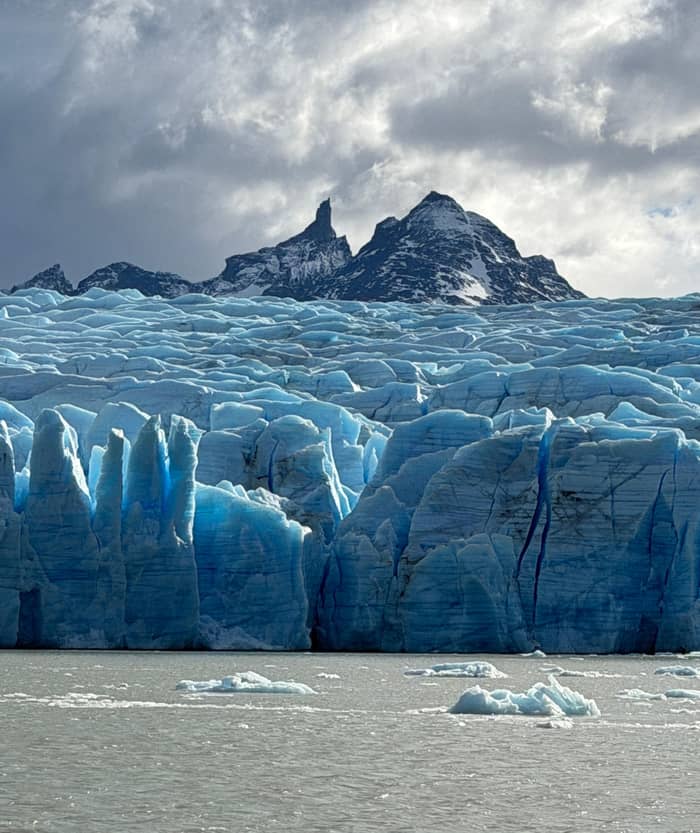
Classic
Sail to the ice
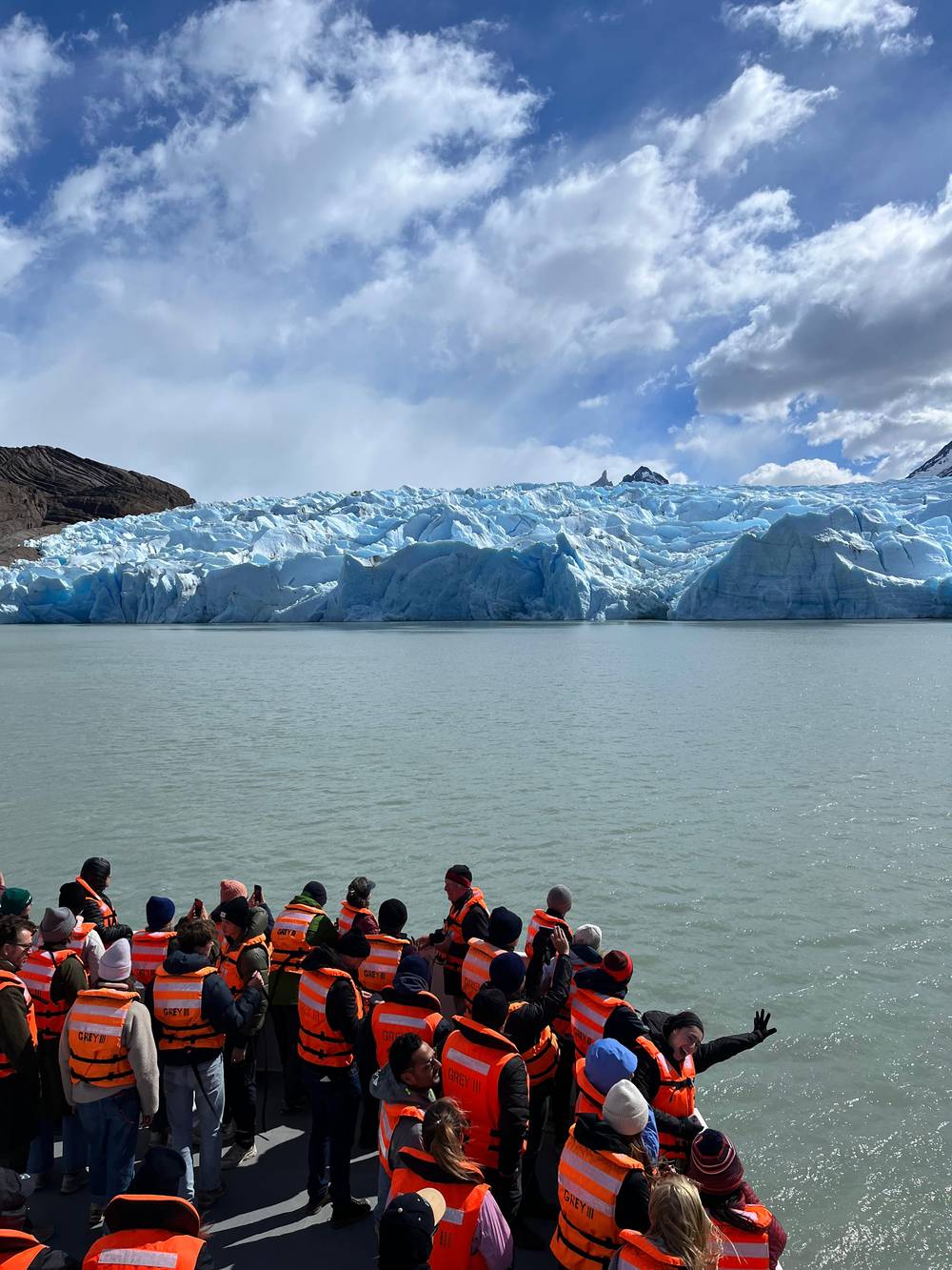
Grey III catamaran
- TimeAbout 3 hours
- StartHotel beach
- SeesGlacier fronts
Find a stop on the map
Brief answer
Lago Grey is the milky glacial lake at the foot of the Grey Glacier, crossed by the Grey III boat from Hotel Lago Grey after a 30 to 45 minute walk over Playa Grey, with stranded icebergs on its black sand beach.
On the shore
Discover 25 stops
Select a route, then tap a marker or stop to see its note and open Google Maps.
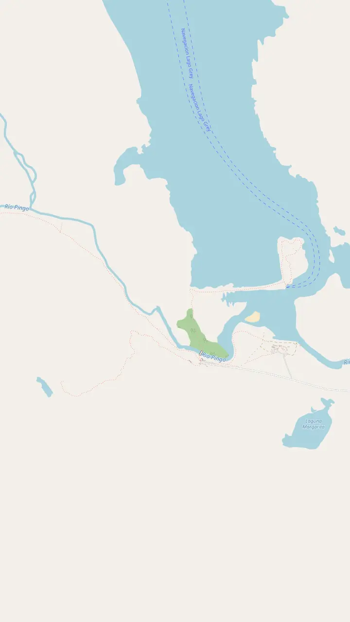
The lakeside hotel that runs the Grey III boat; passengers check in here an hour before each sailing.
Google MapsThe boarding point, reached on foot across Playa Grey in 30 to 45 minutes from the beach car park.
Google MapsThe wooded peninsula at the end of the beach, with a view up the lake to the floating ice and the distant fronts.
Google MapsThe Pingo ranger station and car park at the southern end of the lake, near the Mirador Ferrier trail.
Google MapsA short, steep trail to a wide view over the lakes, as Chile Travel describes it.
Google Maps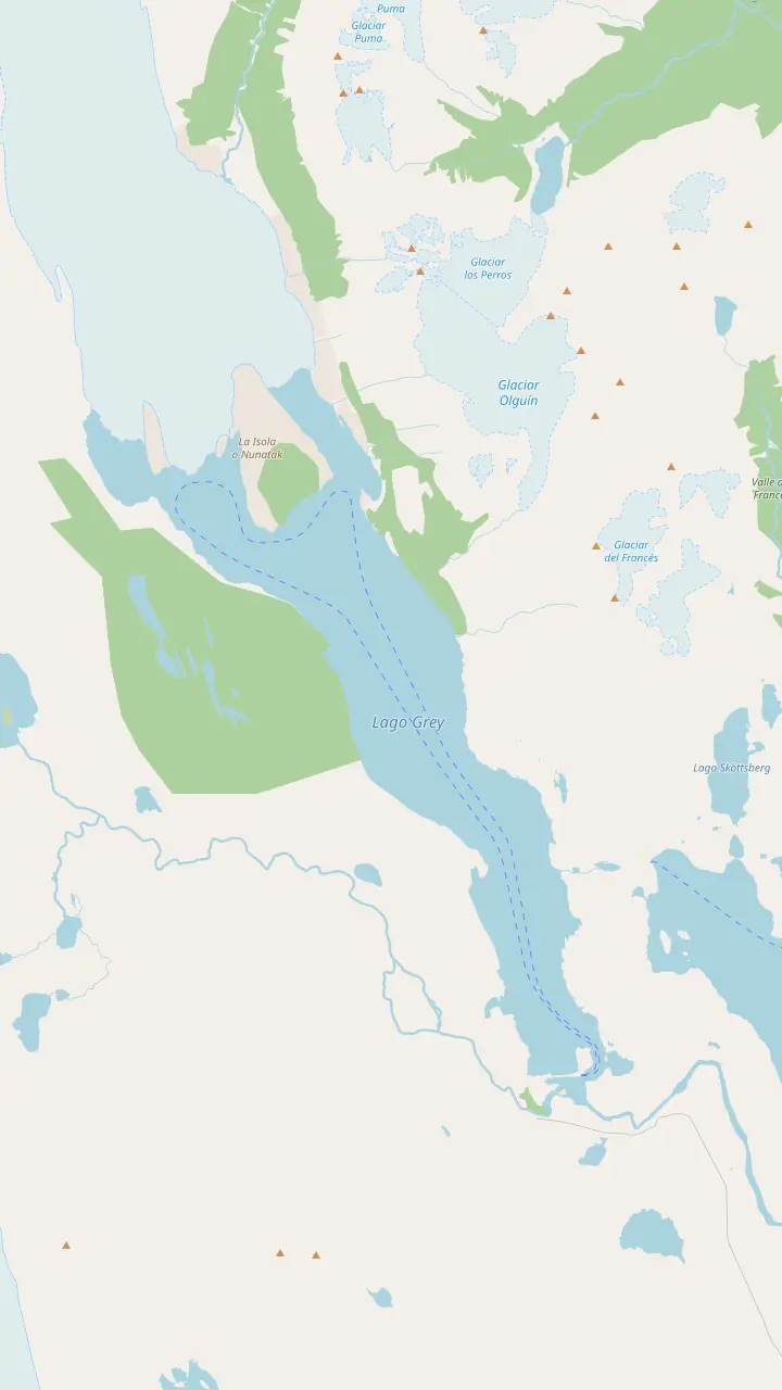
The western front of the glacier; NASA measured the greatest ice loss on this lobe between 1986 and 2007.
Google MapsThe rock island that splits the glacier's end into lobes, the kind of crag glaciologists call a nunatak.
Google MapsThe lookout above the refugio, facing the ice wall and the floes on the lake.
Google MapsThe first hanging bridge on the trail north to Paso; CONAF warns that these bridges stand more than 20 m high.
Google MapsThe campsite at the north end of the Grey trail, with an informal lookout over the glacier.
Google MapsThe refugio near the eastern ice front, reached by trail or by the morning and midday boats.
Google MapsThe boarding point, reached on foot across Playa Grey in 30 to 45 minutes from the beach car park.
Google MapsThe lakeside hotel that runs the Grey III boat; passengers check in here an hour before each sailing.
Google MapsThe wooded peninsula at the end of the beach, with a view up the lake to the floating ice and the distant fronts.
Google Maps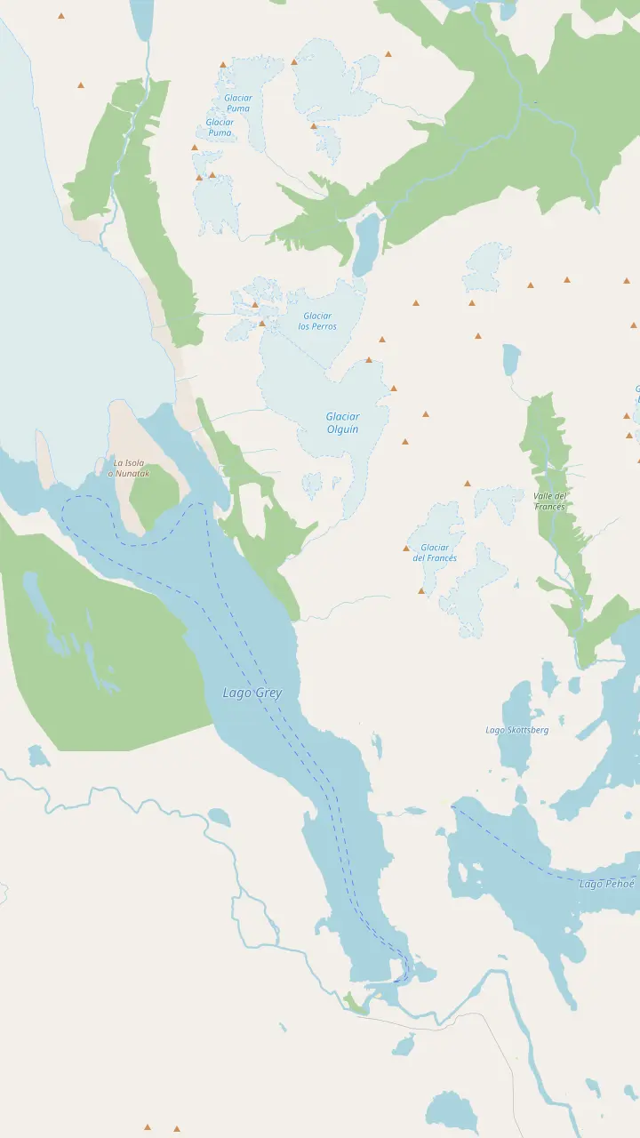
The lodge and campsite where the Grey leg starts; it is 11 km to Refugio Grey.
Google MapsThe pier where the catamaran from Pudeto lands walkers at Paine Grande.
Google MapsA small lake passed on the trail between Paine Grande and Refugio Grey.
Google MapsThe lookout on the W where the lake and the ice first open up ahead of walkers from Paine Grande.
Google MapsThe refugio near the eastern ice front, reached by trail or by the morning and midday boats.
Google MapsThe lookout above the refugio, facing the ice wall and the floes on the lake.
Google MapsThe first hanging bridge on the trail north to Paso; CONAF warns that these bridges stand more than 20 m high.
Google MapsThe campsite at the north end of the Grey trail, with an informal lookout over the glacier.
Google MapsThe highest summit of the Paine massif, at 3,050 m by CONAF's figure.
Google Maps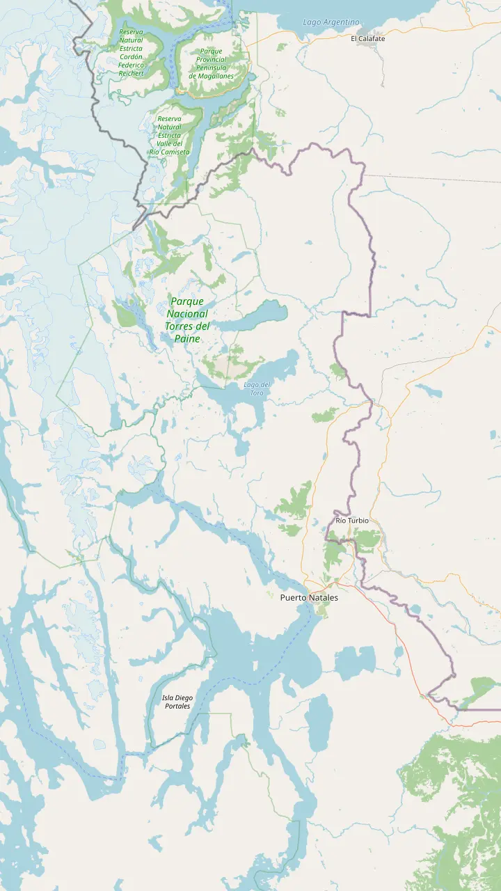
The gateway town for the park, 80 km from its entrance by Chile Travel's figure.
Google MapsThe Teniente Julio Gallardo airfield, 15 minutes from the town center.
Google MapsThe village at the Río Don Guillermo crossing, 52 km from the park's Sarmiento entrance.
Google MapsThe eastern park entrance, about 2 hours by bus from Puerto Natales.
Google MapsThe landing on Lago Pehoé, with a cafeteria, where buses and the catamaran meet.
Google MapsThe Pingo ranger station and car park at the southern end of the lake, near the Mirador Ferrier trail.
Google MapsThe lakeside hotel that runs the Grey III boat; passengers check in here an hour before each sailing.
Google Maps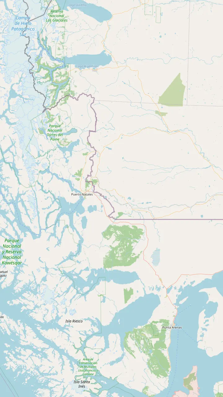
The regional capital, 250 km and about 3 hours by road from Puerto Natales.
Google MapsThe Carlos Ibáñez del Campo airport, open all year with daily flights from Santiago.
Google MapsThe gateway town for the park, 80 km from its entrance by Chile Travel's figure.
Google MapsThe Teniente Julio Gallardo airfield, 15 minutes from the town center.
Google MapsThe village at the Río Don Guillermo crossing, 52 km from the park's Sarmiento entrance.
Google MapsThe Chilean border complex on the road to El Calafate, open to all vehicles, at 260 m above sea level.
Google MapsThe Argentine town on the far side of the border, 5 hours from Puerto Natales by scheduled bus.
Google MapsThe eastern park entrance, about 2 hours by bus from Puerto Natales.
Google MapsThe lakeside hotel that runs the Grey III boat; passengers check in here an hour before each sailing.
Google MapsMap data: © OpenStreetMap contributors
Editorial team, greyglaciercruise.click · Updated November 12, 2026 · Reading: 7 min
The Lago Grey glacier in Torres del Paine and the lake it feeds are best understood as a pair. NASA traces the glacier from the Patagonian Andes in the west down to a front that splits into three lobes where it enters the water,1 and Chile Travel calls the glacier the main attraction of the park's western sector.6 Everything you do here, from the beach walk to the boat, happens on the shore of that lake.
In Torres del Paine, Lago Grey glacier views begin long before the ice itself. Chile Travel's itinerary for the park calls the lake milky, its surface scattered with blue floes of ice, reached after an 80 km drive across the park to the western sector.2 From the southern end you see the lake stretch north towards the ice, with the Paine massif rising to the east and the floating blocks scattered in between.
The hotel that runs the boat sits on that southern shore, and Chile Travel reckons about 100 km, roughly 2 hours on the park's internal roads, between Puerto Natales and this end of the lake.7 CONAF lists the lake among the places where catamarans sail inside the park, together with Lago Pehoé.8 It is a working lake as well as a view, with boats, trekkers and day visitors sharing the same beach.
Around the shore
| Place | What it is | How you get there |
|---|---|---|
| Hotel Lago Grey | Hotel and boat check-in | By road |
| Playa Grey | Black sand beach, stranded ice | On foot from the hotel |
| Refugio Grey | Mountain lodge and campsite | Trail or boat |
| Mirador Ferrier | Steep lookout over the lakes | On foot |
| Grey River | Outflow and open terrace | Seen from the road |
Lodging access per CONAF; beach and lookout descriptions from Chile Travel, the boat operator and the CEQUA guide.4,14,11,15
The color comes from the glacier. NSIDC explains that a glacier grinds a fine powder of silt and clay as its rock-laden ice scrapes over bedrock, and that meltwater carries this rock flour away and makes water look powdery gray.12 Lakes fed by glaciers can even show bands of different shades where the flour spreads unevenly through the water, and Lago Grey shows exactly that milky look.
Hotel Lago Grey describes the scene from the boat as radiant blue ice and icebergs floating in turquoise-grey water.13 The contrast is the point: the opaque, pale lake makes the ice look even bluer, and on a gray day the water and sky can merge into a single soft tone with only the floes picking out the horizon. On sunnier days the turquoise comes through more strongly near the shore.
The milky water also hides what lies beneath. You cannot see far into it, and the park's rules keep people out of the water in any case,5 and the stranded ice is best enjoyed from dry land, with the black sand and the gray lake as a backdrop.
A morning at the lake
Check-in
Check-in opens an hour before the sailing.
Beach walk
A walk on foot to the boarding area.3
Sailing
The catamaran crosses towards the fronts.9
At the refugio
Morning and midday boats stop at Refugio Grey.10
Return
The same walk brings you back to the hotel.
Afternoon
A short climb to a viewpoint, or the road home.11
To board the catamaran you walk. Hotel Lago Grey says the only way to reach its boat is a walk of 30 to 45 minutes across Playa Grey to the boarding area,3 and Chile Travel's itinerary describes walking along a black sand beach before stepping aboard.14 The tour sold on this site lists the same pattern, with time on foot either side of the sailing. Allow for that walk when you plan the day.
The beach is not suited to everyone. The operator states that the walk is unsuitable for people with reduced mobility,19 so travelers using wheelchairs or walking aids should contact it before booking. The CEQUA guide to the park lists the Grey beach among the road-accessible sites of a full-day visit, alongside Salto Grande and the visitor center,16 so even without a boat ticket it is a natural stop.
Weather can close the beach trail. CONAF shut the Playa Grey trail along with several others from 10 November 2026 under a preventive warning for gusts, rain and possible storms.20 Wildlife can appear too: the CEQUA guide includes a photograph of a huemul, the endangered Andean deer, on the Lago Grey beach,18,21 and CONAF prohibits feeding or disturbing native animals anywhere in the park.22
Your time on the shore
Choose by time, effort and how close you want to get.
If I want to reach the ice
Take the boat
The catamaran crosses the lake to the fronts.9
If I have an hour to spare
Walk the beach
Playa Grey is a stop on full-day park visits.16
If I want a view from above
Climb Mirador Ferrier
A steep trail with a wide view of the lakes.11
If I want to sleep by the lake
Stay at the hotel or refugio
Road access at the hotel, trail or boat to the refugio.4
If I want to paddle
Go with a licensed operator
Private boats need permits and a certificate.17
Time at the lake
Classic
Grey III catamaran
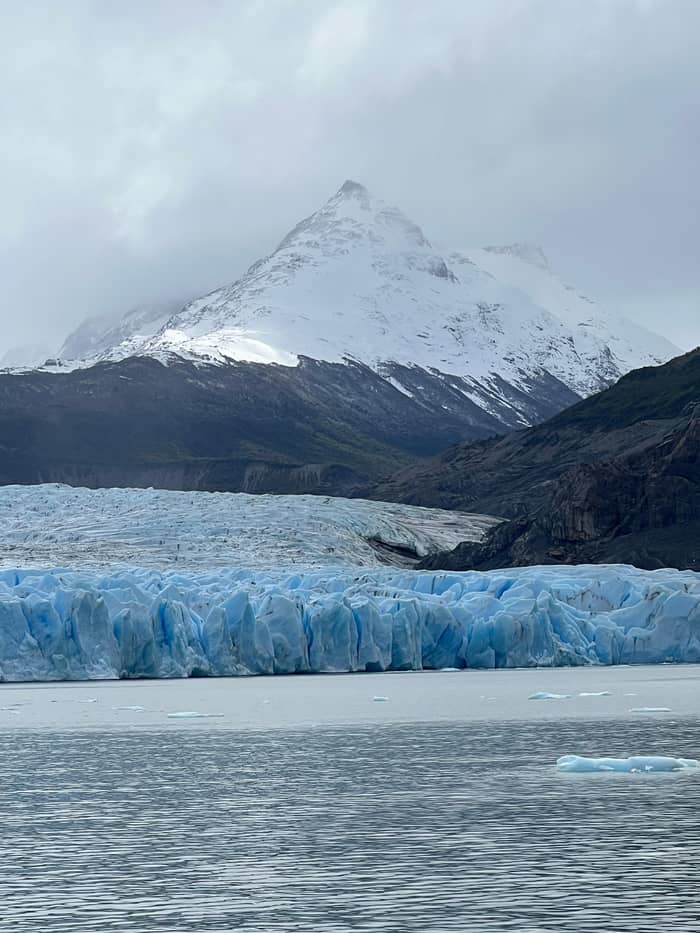
On foot
Playa Grey
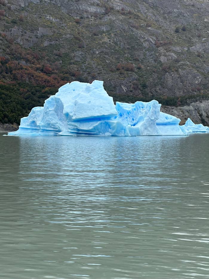
Steep
Mirador Ferrier
The lake does not end at the beach. At its southern end the water leaves as the Grey River, and the CEQUA guide describes the river's terrace as a landscape of open plains that was grazed by livestock before the land became a protected area.15 From the hotel side you look across this lower valley, while the main body of the lake runs north into the mountains towards the ice.
The slopes around the lake are forest. The same guide describes lenga and Magellan coigüe woodland on the flanks of the lake and the glacier, much of it heavily affected by past forest fires.43 The burned trunks you may see on the hillsides are a reminder to take seriously CONAF's ban on every heat source in the park, from campfires and stoves to cigarettes.44
Above the forest stand the peaks. Hotel Lago Grey points out the views of Paine Grande and the Paine massif on the way to the glacier,45 and CONAF gives 3,050 m for the massif's highest point.37 On a clear day the combination of granite, ice and pale water is what fills most photographs taken from the shore, and it changes with every cloud that moves over the range.
On the water
The boat from the hotel, or a day that includes the road.
Compare 3 alternatives
The boat from the hotel, or a day that includes the road.
≈
View≈
View≈
ViewGetYourGuide's starting prices, converted at the ECB reference rate; exact pricing appears when you book.
CONAF lists Hotel Lago Grey among the park's lodgings with road access, while Refugio Grey, near the glacier on the eastern shore, has no vehicle access.4 The refugios and campsites of the western and northern sectors, Grey among them, are run by Vértice Patagonia, according to Chile Travel,46 and the refugio is a stop for the boat as well as for walkers coming up the W.
Hotel Lago Grey stays open all year47 and, because the distances in the region are long, recommends a stay of at least 3 nights in the park.48 Staying on the shore removes the long morning drive from Puerto Natales and puts the early sailing within easy reach. If you are on a budget, the campsites and refugios along the W trail are the alternative, booked well in advance.
The basics are limited. CONAF notes chlorinated drinking water at the busy roadside areas of Pudeto and Lago Grey,41 but nowhere in or near the park sells fuel,38 and Chile Travel advises bringing cash from Puerto Natales because the park has no ATMs.39 Mobile phone signal exists only at Villa Monzino,49 so download maps and tickets before you arrive at the lake.
Video
GEO GIRL on YouTube · Nothing is fetched until you hit play.
Huemul on the Lago Grey beach, an area highly visited by tourists.
At the shore
Navigation on the lake is tightly managed. The CEQUA guide explains that Lagos Grey and Pehoé are public-use zones because regulated navigation is allowed on both,50 and on Grey the hotel's catamaran is the boat that day visitors can book. Hotel Lago Grey's trip runs for about 3 hours aboard the Grey III,9 crossing the lake to the fronts and back.
The same boat links the shore to the trail. The morning and midday boats call first at Refugio Grey on a fixed timetable, letting trekkers who hold single-leg tickets board or leave, and only then head on to the ice.10 Passengers with round-trip tickets stay aboard.51 For walkers this turns the lake into a shortcut, and for day visitors it adds a stop where you can watch backpackers arriving from the trail.
Bringing your own boat is a different matter. CONAF allows private navigation only under special permits issued at the park administration, and any kayak or inflatable needs a certificate showing it has been disinfected, issued by an independent firm based in Puerto Natales.17 For most visitors the practical choice is a guided outing with a licensed operator rather than a craft of their own.
The shore has short walks of its own. Chile Travel lists the Mirador Ferrier among the park's quick viewpoints, warning of a steep climb that pays off with a wide view over the lakes.11 Closer to the hotel, the peninsula at the end of the beach is marked on the map above, and the Pingo ranger station sits at the southern end of the lake. Each makes a good use of an hour while you wait to board.
Watch the time. In the summer season the park's 2026-2027 bulletin takes the last walkers onto the Playa Grey trail at 16:00 and closes it at 19:00, and the Mirador Ferrier takes its last at 13:00,52 while walking without daylight is prohibited.53 The hotel opens check-in an hour ahead of every sailing, so if you plan a lookout climb before the boat, leave margin for the walk back and the beach crossing that follows it. A rushed descent on a steep path is how ankles get twisted.
Treat the shore as part of a protected area. Swimming is banned in every lake and river of the park,5 taking stones, plants or other natural objects is prohibited,42 and drones are prohibited.54 Take your litter with you, stay on the marked paths and give any wildlife on the beach plenty of space. The lake will look different on your next visit, but only if everyone leaves it as they found it.
FAQ
Glaciers grind rock into fine silt and clay that meltwater carries into lakes, turning the water powdery gray.12
Swimming is prohibited in all the park's lakes, lagoons and rivers because of the risk of drowning.5
CONAF lists drinking water at the busy roadside areas of Pudeto and Lago Grey.41
Private boats need special permits and a disinfection certificate.17
Sources
More to read
Planning the boat to Grey Glacier? Ask a real person.