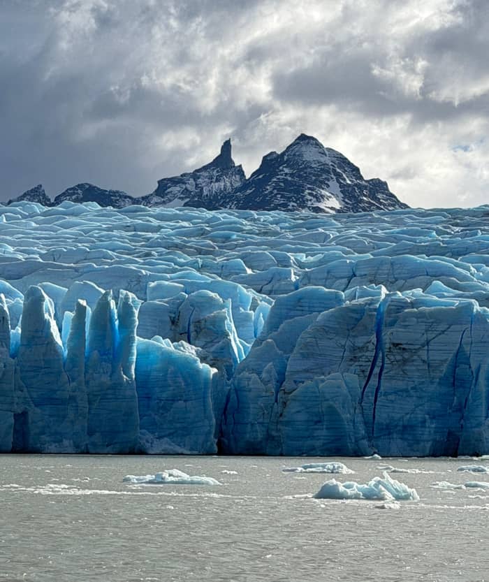
Closest
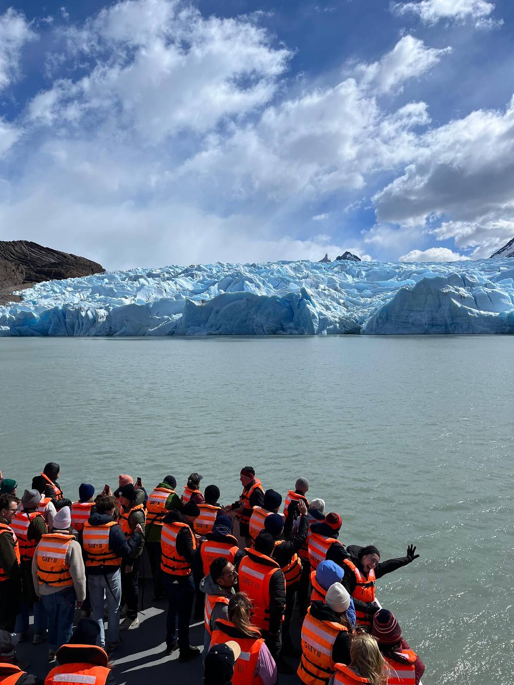
From the boat
Grey III catamaran
- TimeAbout 3 hours
- StartHotel Lago Grey beach
- SeesThe ice fronts
Find a stop on the map
Brief answer
The Grey Glacier is an outlet of the Southern Patagonian Ice Field in Torres del Paine National Park, about 28 km long with ice walls up to 30 m high, ending in three lobes in Lago Grey and retreating.
Key facts
Discover 25 stops
Select a route, then tap a marker or stop to see its note and open Google Maps.
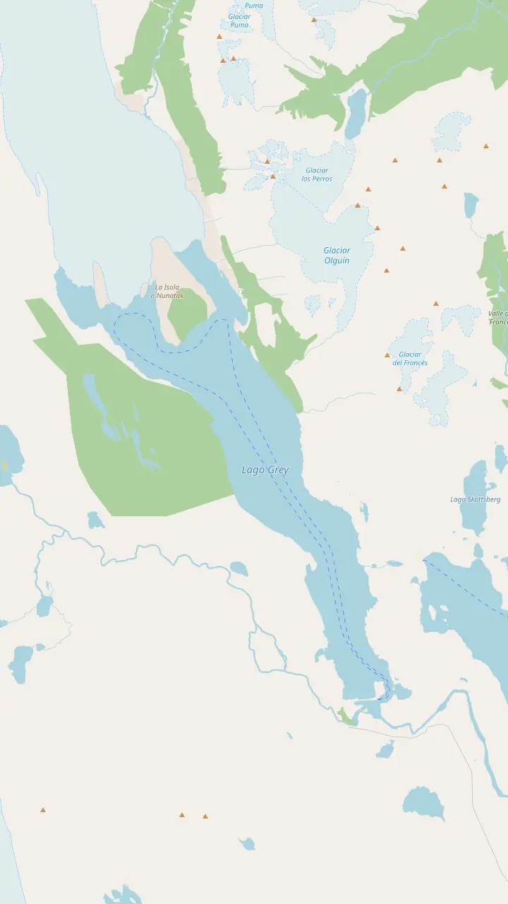
The western front of the glacier; NASA measured the greatest ice loss on this lobe between 1986 and 2007.
Google MapsThe rock island that splits the glacier's end into lobes, the kind of crag glaciologists call a nunatak.
Google MapsThe lookout above the refugio, facing the ice wall and the floes on the lake.
Google MapsThe first hanging bridge on the trail north to Paso; CONAF warns that these bridges stand more than 20 m high.
Google MapsThe campsite at the north end of the Grey trail, with an informal lookout over the glacier.
Google MapsThe refugio near the eastern ice front, reached by trail or by the morning and midday boats.
Google MapsThe boarding point, reached on foot across Playa Grey in 30 to 45 minutes from the beach car park.
Google MapsThe lakeside hotel that runs the Grey III boat; passengers check in here an hour before each sailing.
Google MapsThe wooded peninsula at the end of the beach, with a view up the lake to the floating ice and the distant fronts.
Google Maps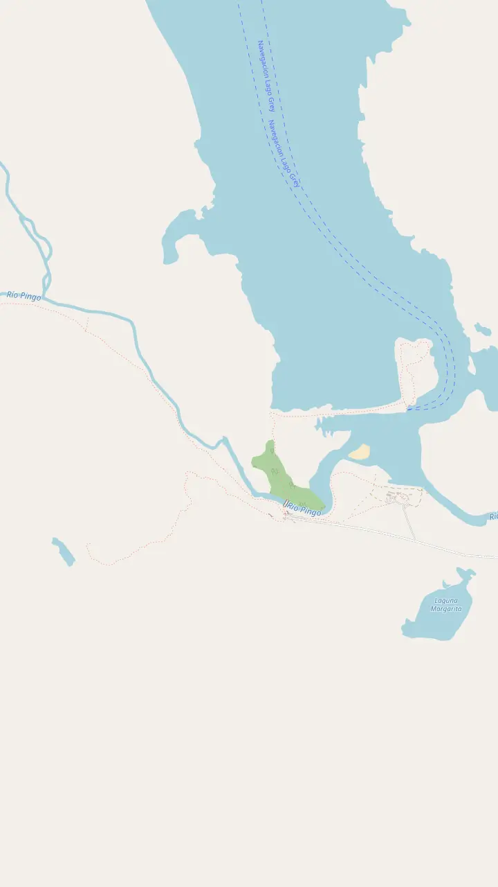
The lakeside hotel that runs the Grey III boat; passengers check in here an hour before each sailing.
Google MapsThe boarding point, reached on foot across Playa Grey in 30 to 45 minutes from the beach car park.
Google MapsThe wooded peninsula at the end of the beach, with a view up the lake to the floating ice and the distant fronts.
Google MapsThe Pingo ranger station and car park at the southern end of the lake, near the Mirador Ferrier trail.
Google MapsA short, steep trail to a wide view over the lakes, as Chile Travel describes it.
Google Maps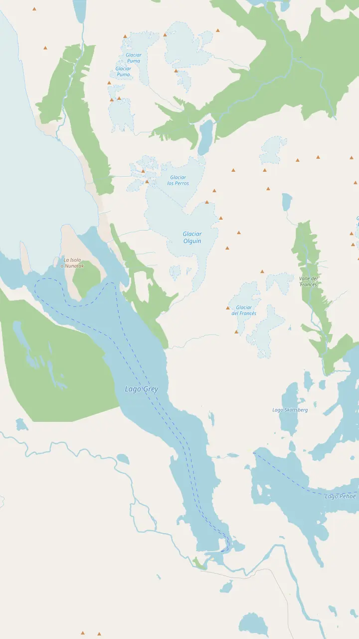
The lodge and campsite where the Grey leg starts; it is 11 km to Refugio Grey.
Google MapsThe pier where the catamaran from Pudeto lands walkers at Paine Grande.
Google MapsA small lake passed on the trail between Paine Grande and Refugio Grey.
Google MapsThe lookout on the W where the lake and the ice first open up ahead of walkers from Paine Grande.
Google MapsThe refugio near the eastern ice front, reached by trail or by the morning and midday boats.
Google MapsThe lookout above the refugio, facing the ice wall and the floes on the lake.
Google MapsThe first hanging bridge on the trail north to Paso; CONAF warns that these bridges stand more than 20 m high.
Google MapsThe campsite at the north end of the Grey trail, with an informal lookout over the glacier.
Google MapsThe highest summit of the Paine massif, at 3,050 m by CONAF's figure.
Google Maps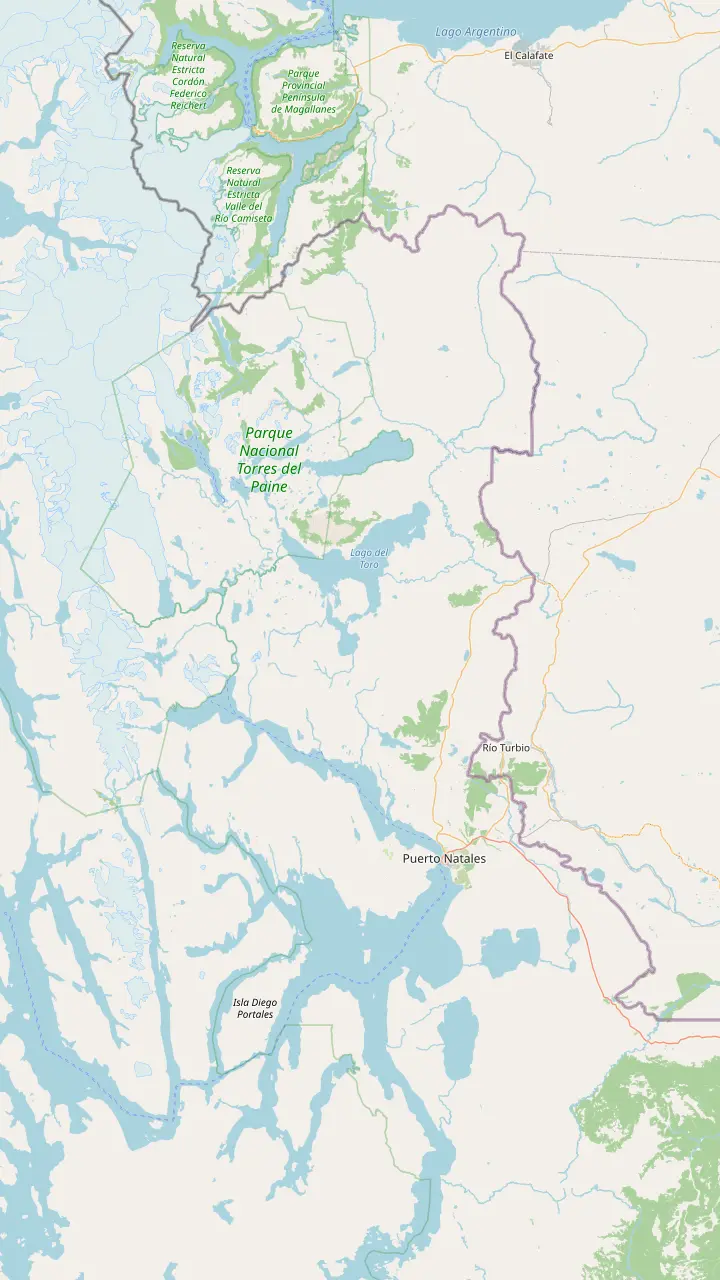
The gateway town for the park, 80 km from its entrance by Chile Travel's figure.
Google MapsThe Teniente Julio Gallardo airfield, 15 minutes from the town center.
Google MapsThe village at the Río Don Guillermo crossing, 52 km from the park's Sarmiento entrance.
Google MapsThe eastern park entrance, about 2 hours by bus from Puerto Natales.
Google MapsThe landing on Lago Pehoé, with a cafeteria, where buses and the catamaran meet.
Google MapsThe Pingo ranger station and car park at the southern end of the lake, near the Mirador Ferrier trail.
Google MapsThe lakeside hotel that runs the Grey III boat; passengers check in here an hour before each sailing.
Google Maps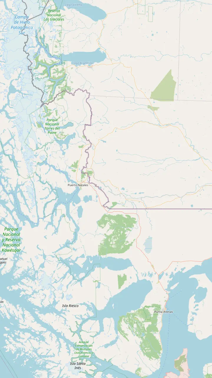
The regional capital, 250 km and about 3 hours by road from Puerto Natales.
Google MapsThe Carlos Ibáñez del Campo airport, open all year with daily flights from Santiago.
Google MapsThe gateway town for the park, 80 km from its entrance by Chile Travel's figure.
Google MapsThe Teniente Julio Gallardo airfield, 15 minutes from the town center.
Google MapsThe village at the Río Don Guillermo crossing, 52 km from the park's Sarmiento entrance.
Google MapsThe Chilean border complex on the road to El Calafate, open to all vehicles, at 260 m above sea level.
Google MapsThe Argentine town on the far side of the border, 5 hours from Puerto Natales by scheduled bus.
Google MapsThe eastern park entrance, about 2 hours by bus from Puerto Natales.
Google MapsThe lakeside hotel that runs the Grey III boat; passengers check in here an hour before each sailing.
Google MapsMap data: © OpenStreetMap contributors
Editorial team, greyglaciercruise.click · Updated November 12, 2026 · Reading: 8 min
The Grey Glacier in Torres del Paine National Park is the visible end of something much larger. CONAF, the agency that runs the park, traces its lakes and rivers to the Southern Patagonian Ice Field, which it ranks as the third largest mass of ice on the planet after Antarctica and Greenland, covering 13,500 km2.1 Grey is among the glaciers that drain it, alongside the Dickson, Zapata, Tindall and Geike.6
Glaciologists call a tongue like this an outlet glacier, a valley glacier that drains an inland ice mass through a gap in the mountains around it.7 An icefield, in the same vocabulary, is a body of glacier ice shaped by the ground beneath it, similar to an ice cap but generally smaller.8 Seen from the boat, Grey looks like a single wall, yet the Grey Glacier in Torres del Paine and its ice field work as a single system, and the front is only the last stretch of ice that set out far to the west.
Inside the park, a guide to the park published by the CEQUA research centre lists Grey with the Tyndall, Dickson, Zapata and Pingo glaciers as part of the Southern Ice Field that falls within the protected area.9 Chile Travel calls Grey the main attraction of the western sector of Torres del Paine,10 and it is the sight that draws visitors out to the far end of the park road.
In numbers
| Measure | Figure | Source |
|---|---|---|
| Length | 28 km | Chile Travel; NASA |
| Area | 270 km2 | NASA, 1996 survey |
| Front height | 30 m | Chile Travel |
| Ice field | 13,500 km2 | CONAF |
| Tyndall length | 32 km | NASA, 1996 survey |
| Tyndall area | 331 km2 | NASA, 1996 survey |
| Park area | 227,298 ha | CONAF |
Figures as each agency publishes them; the 1996 survey values come from NASA's Earth Observatory.2,3,4,1,17,15
By Chile Travel's account the ice travels 28 km out of the Southern Ice Fields before it meets the lake that bears its name and breaks up into floating blue blocks.2 NASA's Earth Observatory gives the same length from a 1996 survey, together with a measured area of 270 km2, and notes that the ice begins in the Patagonian Andes to the west.3 For a sense of scale, the whole park covers 227,298 hectares by CONAF's figure.15
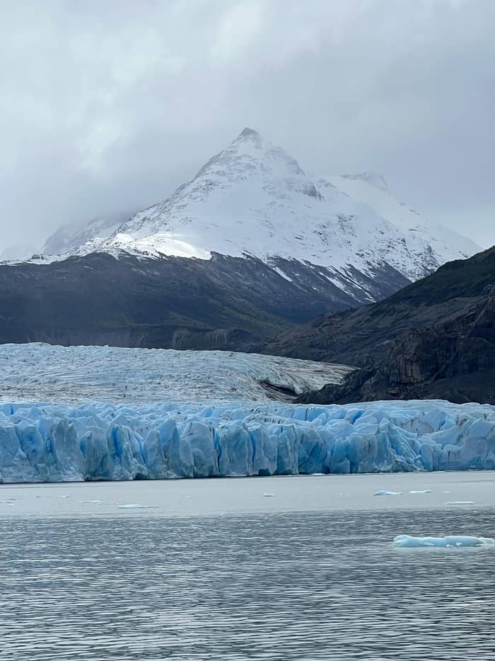
The part you meet face to face is the front. Chile Travel puts the height of the ice walls at 30 m,4 the boat listing calls the front wall over 25 m tall, and Chile Travel's itinerary for the park has the catamaran approaching each of the three fronts.16 Below the waterline the ice continues out of sight, so the wall you photograph is only the upper part of the front. Use the boat or the trekkers on the shore for scale, since ice gives the eye few clues about size.
Its neighbor makes a useful comparison. The Tyndall Glacier, also in Torres del Paine and ending in Lago Geikie, measured 331 km2 and 32 km in the same 1996 survey,17 and NASA places Grey about 30 km to the north-northeast of it.18 Above both rises the Paine massif, whose highest summit reaches 3,050 m by CONAF's figure,19 and on clear days it forms the backdrop to the whole western sector.
Key dates
13 May 1959
A decree creates the park that grew into Torres del Paine.11
1962
State land added; the Torres del Paine name adopted.12
1978
UNESCO's programme recognizes the park.13
1986
The baseline for NASA's comparison of the fronts.14
1996
270 km2 and 28 km measured.3
2007
All lobes shown farther back than in 1986.5
From the air the glacier does not end in a single straight line. NASA describes Grey as terminating in three distinct lobes in Grey Lake,3 and Chile Travel's itinerary has the boat approaching the three fronts of the glacier so passengers can see their textures, cracks and deep blue tones.16 Between the lobes stands a rocky island, the feature glaciologists call a nunatak, a crag that rises out of the ice that flows around it.23
The broken surface you see from the deck has its own explanation. Crevasses are cracks that open where a glacier flows fast and friction pulls the ice apart,24 and NASA notes that Grey's crevasse patterns are complex, perhaps because of its three-lobed end.25 Look for the jagged towers along the front: they are what remains when crevasses meet near the edge of the ice.
Not all of the glacier is white or blue. NASA points out that some parts really are gray, where moraines of soil and rock debris build up along the edges of the moving ice.26 Where feeder glaciers merge, the debris from their sides joins in the middle of the combined glacier as long dark stripes,27 which you can follow with your eye from the fronts back up the ice towards the mountains.
Choose your view
Start from how much time and effort you want to spend.
If I want the closest look at the ice
Take the boat
The catamaran sails in front of the three fronts.16
If I am already walking the W
Hike to the Grey viewpoints
The round trip from Paine Grande takes about 8 hours.20
If I want to hear ice falling
Stay on deck near the fronts
Passengers may see and hear ice break off.21
If I want an aerial photo
Use the high lookouts
Drones are prohibited inside the park.22
If I have a single day from Natales
Boat with transfer
A tour with transport covers the drive both ways.
Viewpoints
Closest
Grey III catamaran
On foot
Paine Grande to Grey
Farther north
Informal lookout
A glacier moves by more than a single mechanism. The ice deforms under its own weight, and the whole mass slides over the rock and sediment at its base,49 so a tongue like Grey keeps carrying new ice down from the ice field even in years when its front is losing ground. The ice reaching the lake today fell as snow on the high plateau long ago, and it has been compressed and carried downhill ever since. The blue blocks floating past the boat are that old snow, finally reaching open water.
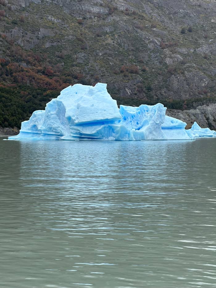
That is why a retreating glacier is not a glacier running backwards. NSIDC puts it simply: a shrinking glacier still flows downhill, it simply melts faster than it flows.50 At Grey the front loses ice by calving, the process in which blocks break off the end where it meets the water, producing large chunks of floating ice.51 The icebergs on Lago Grey are that process made visible.
Sound is part of the experience. Hotel Lago Grey tells its passengers that, with some luck, they may see and hear pieces of glacier ice break away and fall into the lake.21 Nothing about it can be scheduled. Stay on the outer deck while the boat holds position near the fronts, keep a camera ready and listen for the crack that comes just before a block drops into the water.
Go and see it
From the hotel beach, or with the road from town.
Compare 3 alternatives
From the hotel beach, or with the road from town.
≈
View≈
View≈
ViewGetYourGuide's starting prices, converted at the ECB reference rate; exact pricing appears when you book.
Satellite and space station images record the change. NASA's Earth Observatory compared an astronaut photograph from 2007 with a Landsat image from 1986,14 and found that all three lobes had retreated over those 22 years, with the greatest loss at the westernmost front.5 The same account explains the retreat as ice loss exceeding the snow that replaces it, most likely through warmer regional temperatures and shifts in precipitation.52
Dramatic moments punctuate the slow trend. Chile Travel notes that part of the glacier broke off in 2017 and that the ice still draws visitors today,53 and NASA recorded significant ice loss at Grey in 2007, the same year it studied the Tyndall Glacier to the south.18 Large breaks like these send rafts of ice down the lake, and they can change what the boat finds from season to season.
The park's other glaciers tell a longer story. CONAF singles out the Dickson glacier, in the north of the park, which retreated an average of 17 m a year between 1897 and 1943 according to its records.6 None of these figures predict what Grey will look like on your trip, but they explain why guides talk about the glacier as a moving target, and why photographs from older visits rarely match the view from today's deck.
Video
Swanson Digital on YouTube · Nothing is fetched until you hit play.
All three lobes have retreated over the 22-year period, with the greatest loss of ice occurring along the westernmost lobe terminus.
On the day
The lake at its foot gave the park its first name. The CEQUA guide recounts that a decree of 13 May 1959 created the Parque Nacional Turismo Lago Grey, the starting point of today's park, on 4,332 ha of the old Estancia Pudeto land.11 In 1962 another 20,200 ha of state land were added and the park took the Torres del Paine name.12 CONAF dates the founding decree, number 383 of the Ministry of Agriculture, to the same day in 1959, as its records show.54
International recognition followed. UNESCO's Man and the Biosphere programme declared Torres del Paine a Biosphere Reserve in 1978, as CONAF records,13 and the lake beneath the glacier remains a public-use zone where regulated navigation is allowed, alongside Lago Pehoé.55 Every boat on the lake operates within that framework, under rules the park sets, and the catamaran that carries day visitors to the fronts is part of that regulated traffic.
Protection covers what lives around the ice as well. The CEQUA guide describes the slopes of the lake and glacier as lenga and Magellan coigüe forest, much of it damaged by past fires,56 and among its photographs is a huemul, Chile's endangered native deer, standing on the lakeshore beach.57,58 Lighting any kind of fire, from a stove to a cigarette, is banned in the park today.47 On the beach and the lookouts, that rule applies just as strictly as on the long trails.
The boat gives the closest view of the ice. Hotel Lago Grey's catamaran makes the trip in about 3 hours,59 and the tour offered on this site is that same sailing from the hotel beach, guided in English and Spanish. Chile Travel suggests setting aside a full day for the trip,45 since the drive in from Puerto Natales takes about 2 hours before you even reach the beach.60
Walkers have their own angles. On the W trek, the hike from Paine Grande to the Grey viewpoints and back takes about 8 hours and ends facing the ice wall and the floes on the lake,20 and further north the CEQUA guide pictures the glacier from an informal lookout at Campamento Paso.33 The park's 2026-2027 bulletin lists the CONAF camp at Paso as permanently closed, and the O circuit that passes it is open from 1 November 2026 to 31 March 2027.61,62 The glacier tab of the map above pins the refugio, the lookout and the hanging bridge along that stretch.
An aerial view is off the table for visitors. CONAF prohibits drones inside the park,22 so plan on deck photographs rather than overhead shots, and leave the drone in your bag at the gate rather than risk a ranger's attention on the trail. If you want height, the lookouts above the lake and the trail north of the refugio give a raised view of the fronts, and on a clear day the Paine massif stands behind the ice.
FAQ
Chile Travel gives 30 m for the front walls; the boat listing says over 25 m.4
CONAF ranks it as the third largest ice mass on Earth, at 13,500 km2.1
NASA found that all three lobes retreated between 1986 and 2007, the western lobe most.5
Chile Travel notes that part of the glacier broke off that year.53
CONAF prohibits drones inside the park.22
Sources
More to read
Planning the boat to Grey Glacier? Ask a real person.